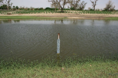
 Permanent Mare of Tombo, ©Photo : S. Bachir, IRD
In SW Niger, close to Niamey, a detailed hydrological survey has been developed for the last 25 years over 10 000 km2 by the international experiments Hapex Sahel and AMMA. Quality and consistency of these long-term observations allowed assessing the causes and the consequences of global change in the region. The most original and paradoxical scientific result is the continuous rise of the water table, proven to have existed even before, during the severe droughts of the 1970s and 1980s. This rise (about 4 m in 40 years) is explained by a change in land use from natural woody savannah to rain-fed crops that led to an increase in Hortonian runoff collected in numerous temporary endoreic ponds where surface water infiltrates and recharges the aquifer.
Our study focuses in a subpart of 900 km2, in the SE of the long-term site, where the water table has risen up to outcropping in the lowest valley bottoms, and creating permanent ponds. Their number and size have increased over the past 20 years, as well as the irrigated areas around them during the six-to-seven-month dry season. We supplemented previous measurements with a dense hydrodynamic, geochemical and isotopic (18O, 2H) survey as well as topographic and aerial campaigns (between 2013 and 2016). The new permanent ponds reflect groundwater dynamics while ordinary temporary ponds only reflect surface dynamics. Evaporation strongly affects the permanent ponds and increases significantly its electrical conductivity (EC up to 1000 µS.cm-1) while the natural mineralization of groundwater (i.e. at distances larger than 200 m from a pond) is very low (EC between 20 and 100 µS.cm-1). This increase in salinity due to evaporation is confirmed by the isotopic survey (18O, 2H), showing a progressive enrichment but less than that of temporary ponds water. The use of groundwater for irrigation could avoid soil salinization and also help to mitigate the impacts of rainfall variability on rain-fed crop production.


